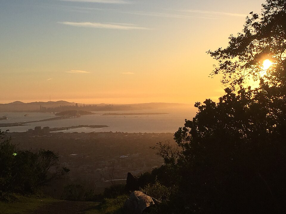
Convict Viewpoint–Quarry Trail, 4 sights is a 10.2-mile out-and-back in Sibley Volcanic Regional Preserve near La Loma Park, CA. The route reaches Convict Viewpoint. It climbs 1,967 ft, with sections as steep as 19% grade, and is mostly dirt. It scores 13/100 on the Ambleway Wildness scale: paved and peopled.
Elevation
0 mi971 – 1,749 ft · steepest grade: 19%10.6 mi
Getting there
Trailhead: Upper Jordan Fire Trail 37.88112, -122.24375
Nearest town La Loma Park, CA
Directions
AMBLEWAYwww.ambleway.com
Convict Viewpoint–Quarry Trail, 4 sights
10.2 mi · ▲ 1,967 ft · 4 hr 23 min
Elevation 971–1,750 ft
Out & Back · Sibley Volcanic Regional Preserve
Trailhead: Upper Jordan Fire Trail · 37.88112, -122.24375
Weather Sep 21: sunrise 6:57 AM · sunset 7:09 PM
Transit-accessible: Space Sciences Lab/MSRI stop 62 m from the trailhead · Parking lot at the trailhead
- Start on Upper Jordan Fire Trail, heading S.
- 0.9 miSharp left onto Convict Trail, heading W.
- 0.6 miPass Convict Viewpoint.
- 150 ftTurn right, heading E.
- 0.4 miBear left, heading S.
- 0.2 miTurn right onto Skyline Trail, heading SE.
- 1.6 miTurn left, heading S.
- 0.8 miTurn left, heading SE.
- 0.2 miTurn right, heading NE.
- 350 ftBear right onto Quarry Trail, heading N.
- 0.3 miContinue straight onto Volcanic Trail, heading E.
- 0.1 miReach Convict Viewpoint, then turn around and head back the way you came.
- 0.2 miContinue straight onto Quarry Trail, heading NW.
- 0.3 miBear left, heading W.
- 300 ftTurn left, heading W.
- 0.2 miTurn right onto Skyline Trail, heading SW.
- 2.4 miTurn left, heading NW.
- 0.2 miBear right, heading NW.
- 0.4 miTurn left onto Convict Trail, heading NW.
- 0.6 miSharp right onto Upper Jordan Fire Trail, heading SW.
- 0.7 miArrive back at the trailhead.
Each distance is the walk from the previous step. Tap a step for a map of its junction.
Trail surface
68% dirt17% gravel15% unspecified
Weather
Sunrise 6:57 AMSunset 7:09 PM
Sunset
The best sunset spot on this hike is right at the trailhead, so there is no walk out. Be there by 6:49 PM to have the sun's last 20 minutes of sky before it sets at 7:09 PM. Your car is right there — dark at 7:35 PM.
Good to know
- Transit-accessible: Space Sciences Lab/MSRI stop 62 m from the trailhead
- Parking lot at the trailhead
Other ways to reach this destination
More from Upper Jordan Fire Trail Trailhead
- Lake Anza–Lake Anza Beach, 4 sights 7.5 mi · ▲ 1,422 ft
- Seaview Viewpoint–Lake Anza, 7 sights 8.3 mi · ▲ 2,218 ft
- Lower Jordan Fire Trail & Upper Jordan Fire Trail 5.4 mi · ▲ 659 ft
- Tree Swing–East West Trail, 3 sights 4.6 mi · ▲ 281 ft
- Chaparral Peak–Convict Viewpoint, 3 summits 3.4 mi · ▲ 683 ft
- Golf Course Trail–Grizzly Peak Trail Loop, 3 sights 2.1 mi · ▲ 416 ft
Get outside more
A wild hike near La Loma Park, emailed to you once a week.
Hikes near La Loma Park, California