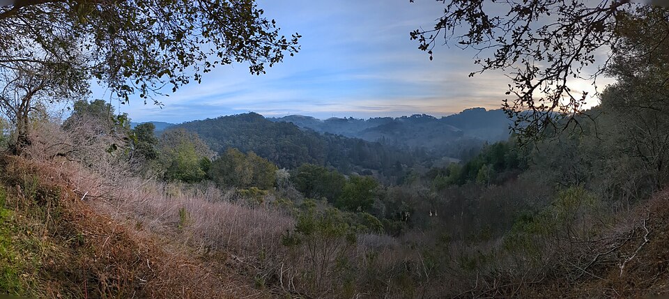
Ridge Viewpoint–Jewel Lake, 8 sights is an 11.9-mile out-and-back in Wildcat Canyon Regional Park near Cragmont, CA. The route passes Jewel Lake before reaching Ridge Viewpoint at the turnaround, 5.9 miles in. It climbs 1,797 ft, with sections as steep as 17% grade, and is mostly dirt. It scores 41/100 on the Ambleway Wildness scale: green fringe.
Elevation
0 mi364 – 955 ft · steepest grade: 17%12.2 mi
Getting there
Trailhead: Unnamed 37.89989, -122.25576
Nearest town Cragmont, CA
Directions
AMBLEWAYwww.ambleway.com
Ridge Viewpoint–Jewel Lake, 8 sights
11.9 mi · ▲ 1,797 ft · 4 hr 52 min
Elevation 365–953 ft
Out & Back · Wildcat Canyon Regional Park
Trailhead: 37.89989, -122.25576
Weather Sep 22: sunrise 6:58 AM · sunset 7:08 PM
Transit-accessible: Lake Anza stop 15 m from the trailhead · Toilets at the trailhead · Drinking water at the trailhead · Parking lot at the trailhead
- Start at the trailhead, heading W.
- 250 ftContinue straight onto Selby Trail, heading W.
- 0.2 miBear left, heading W.
- 0.7 miTurn right onto Memory Trail, heading NW.
- 0.5 miContinue straight onto Upper Packrat Trail, heading NW.
- 0.2 miPass Jewel Lake.
- 200 ftBear right onto Lower Packrat Trail, heading N.
- 250 ftTurn left onto Upper Packrat Trail, heading N.
- 50 ftBear right onto Lower Packrat Trail, heading N.
- 300 ftTurn left onto Wildcat Creek Trail, heading N.
- 2 miSharp right onto Leonards trail, heading NW.
- 0.8 miTurn right onto Mezue Trail, heading N.
- 0.2 miSharp left onto West Slope Track, heading E.
- 1 miTurn right onto Clark Boas Trail, heading NW.
- 50 ftTurn right onto Ridge Trail Connector, heading NW.
- 0.2 miReach Ridge Viewpoint, then turn around and head back the way you came.
- 0.2 miTurn left onto Clark Boas Trail, heading W.
- 50 ftTurn left onto West Slope Track, heading W.
- 1 miSharp right onto Mezue Trail, heading SE.
- 0.2 miTurn left onto Leonards trail, heading W.
- 0.8 miSharp left onto Wildcat Creek Trail, heading S.
- 2 miTurn right onto Lower Packrat Trail, heading SE.
- 300 ftBear left onto Upper Packrat Trail, heading SE.
- 50 ftTurn right onto Lower Packrat Trail, heading SE.
- 250 ftBear left onto Upper Packrat Trail, heading SE.
- 0.3 miContinue straight onto Memory Trail, heading SE.
- 0.5 miTurn left onto Selby Trail, heading SW.
- 0.6 miBear right, heading S.
- 0.2 miArrive back at the trailhead.
Each distance is the walk from the previous step. Tap a step for a map of its junction.
Trail surface
78% dirt16% gravel6% unspecified
Weather
Sunrise 6:58 AMSunset 7:08 PM
Sunset
The best sunset spot on this hike is 0.8 mi in (~21 min). Leave by 6:26 PM for the 7:08 PM sunset. Back at your car by 7:45 PM, after dark — bring a headlamp.
Good to know
- Transit-accessible: Lake Anza stop 15 m from the trailhead
- Toilets at the trailhead
- Drinking water at the trailhead
- Parking lot at the trailhead
Other ways to reach this destination
More from this trailhead
- San Pablo Ridge Viewpoint–Jewel Lake, 8 sights 10.5 mi · ▲ 1,470 ft
- Jewel Lake–Conlon Trail, 8 sights 9.2 mi · ▲ 1,669 ft
- Seaview Viewpoint–Lake Anza Beach, 4 sights 4.5 mi · ▲ 1,258 ft
- Jewel Lake–Memory Trail, 3 sights 3.1 mi · ▲ 475 ft
Get outside more
A wild hike near Cragmont, emailed to you once a week.
Hikes near Cragmont, California