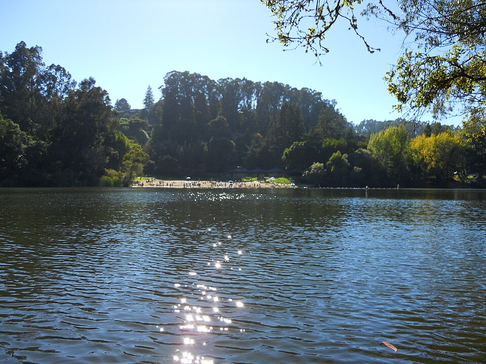
Lake Anza–Lake Anza Beach, 6 sights is a 4-mile out-and-back in Tilden Regional Park near La Loma Park, CA. The route passes Lake Anza and Lake Anza Beach. It climbs 919 ft, with sections as steep as 17% grade, and is mostly dirt. It scores 42/100 on the Ambleway Wildness scale: green fringe.
Elevation
0 mi791 – 1,326 ft · steepest grade: 17%4.8 mi
Getting there
Trailhead: Golf Course Trail 37.88619, -122.23272
Nearest town La Loma Park, CA
Directions
AMBLEWAYwww.ambleway.com
Lake Anza–Lake Anza Beach, 6 sights
4 mi · ▲ 919 ft · 1 hr 48 min
Elevation 790–1,326 ft
Out & Back · Tilden Regional Park
Trailhead: Golf Course Trail · 37.88619, -122.23272
Weather Sep 21: sunrise 6:57 AM · sunset 7:09 PM
Toilets at the trailhead · Drinking water at the trailhead · Parking lot at the trailhead
- Start at the trailhead, heading W.
- 50 ftBear left onto Golf Course Trail, heading W.
- 0.2 miTurn left onto Redwood Trail, heading W.
- 50 ftBear right onto Golf Course Trail, heading W.
- 0.5 miContinue straight onto Redwood Trail, heading SW.
- 300 ftBear right onto Grizzly Peak Trail, heading SW.
- 200 ftTurn right onto Selby Trail, heading W.
- 50 ftBear left, heading SW.
- 150 ftBear left, heading SW.
- 0.9 miPass Lake Anza.
- 50 ftPass Lake Anza Beach.
- 450 ftBear left, heading SE.
- 150 ftTurn left, heading E.
- 50 ftSharp right onto Lake Anza Trail, heading E.
- 300 ftBear left onto Mineral Springs Trail, heading W.
- 0.2 miReach Lake Anza, then turn around and head back the way you came.
- 0.2 miBear right onto Lake Anza Trail, heading NE.
- 300 ftSharp left, heading NE.
- 50 ftTurn right, heading NE.
- 150 ftBear right onto Selby Trail, heading NE.
- 1 miTurn right, heading S.
- 150 ftBear left, heading SW.
- 50 ftTurn left, heading SW.
- 200 ftBear left onto Redwood Trail, heading SW.
- 0.1 miContinue straight onto Golf Course Trail, heading SE.
- 0.4 miBear left onto Redwood Trail, heading SW.
- 50 ftTurn right onto Golf Course Trail, heading SW.
- 0.2 miBear right, heading NE.
- 50 ftArrive back at the trailhead.
Each distance is the walk from the previous step. Tap a step for a map of its junction.
Trail surface
66% dirt1% boardwalk33% unspecified
Weather
Sunrise 6:57 AMSunset 7:09 PM
Sunset
The best sunset spot on this hike is 0.4 mi in (~11 min). Leave by 6:38 PM for the 7:09 PM sunset. Back at your car by 7:37 PM, after dark — bring a headlamp. Car visible from the viewpoint
Good to know
- Toilets at the trailhead
- Drinking water at the trailhead
- Parking lot at the trailhead
Other ways to reach this destination
More from Golf Course Trail Trailhead
- Golf Course Trail via Grizzly Peak Trail 2.2 mi · ▲ 528 ft
- Briones Valley Viewpoint–Arroyo Trail, 3 sights 1.4 mi · ▲ 452 ft
Get outside more
A wild hike near La Loma Park, emailed to you once a week.
Hikes near La Loma Park, California