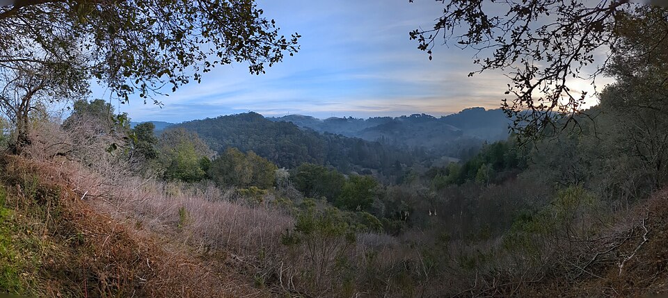
Wildcat Peak–Rotary Peace Grove Overlook, 8 sights is a 3.7-mile out-and-back in Tilden Nature Area near Cragmont, CA. The route passes Jewel Lake and Wildcat Peak before reaching Rotary Peace Grove Overlook at the turnaround, 1.8 miles in. It climbs 978 ft, with sections as steep as 29% grade, and is mostly dirt. It scores 38/100 on the Ambleway Wildness scale: green fringe.
Elevation
0 mi515 – 1,211 ft · steepest grade: 29%4.1 mi
Getting there
Trailhead: Selby Trail 37.90431, -122.26756
Nearest town Cragmont, CA
Directions
AMBLEWAYwww.ambleway.com
Wildcat Peak–Rotary Peace Grove Overlook, 8 sights
3.7 mi · ▲ 978 ft · 1 hr 43 min
Elevation 515–1,211 ft
Out & Back · Tilden Nature Area
Trailhead: Selby Trail · 37.90431, -122.26756
Weather Sep 20: Fog, high 61°F / low 53° · precip 3% · wind 13 mph · sunrise 6:56 AM · sunset 7:11 PM
Transit-accessible: Spruce Street & Grizzly Peak Boulevard stop 193 m from the trailhead · Parking lot at the trailhead
- Start on Selby Trail, heading N.
- 350 ftSharp left onto Memory Trail, heading NW.
- 0.5 miContinue straight onto Upper Packrat Trail, heading NW.
- 0.2 miPass Jewel Lake.
- 200 ftBear right onto Lower Packrat Trail, heading N.
- 250 ftTurn left onto Upper Packrat Trail, heading NW.
- 50 ftBear right onto Lower Packrat Trail, heading NW.
- 300 ftTurn left onto Wildcat Creek Trail, heading NE.
- 150 ftSharp right onto Jewel Lake Trail, heading NW.
- 200 ftBear left onto Sylvan Trail, heading NE.
- 0.2 miSharp left onto Wildcat Peak Trail, heading SE.
- 0.5 miSharp left, heading S.
- 100 ftTurn right, heading S.
- 0.1 miPass Rotary Peace Grove Overlook.
- 100 ftReach Wildcat Peak, then turn around and head back the way you came.
- 200 ftTurn right, heading NE.
- 0.1 miBear right, heading NE.
- 0.5 miSharp right onto Sylvan Trail, heading S.
- 0.3 miBear right onto Jewel Lake Trail, heading SE.
- 200 ftSharp left onto Wildcat Creek Trail, heading N.
- 150 ftTurn right onto Lower Packrat Trail, heading N.
- 300 ftBear left onto Upper Packrat Trail, heading SW.
- 50 ftTurn right onto Lower Packrat Trail, heading SW.
- 300 ftBear left onto Upper Packrat Trail, heading N.
- 0.3 miContinue straight onto Memory Trail, heading S.
- 0.5 miSharp right onto Selby Trail, heading W.
- 200 ftArrive back at the trailhead.
Each distance is the walk from the previous step. Tap a step for a map of its junction.
Trail surface
78% dirt22% unspecified
Weather
FogTemperature 61°F53°
Precip3%Wind13 mphUV6Humidity95%
Hourly temperature
65°50°
Sunrise 6:56 AM12 AM3 AM9 AM12 PM3 PMSunset 7:11 PM
Mon
60°54°
Tue
70°54°
Wed
78°57°
Thu
68°59°
Fri
69°58°
Sat
67°56°
Sunset
The best sunset spot on this hike is right at the trailhead, so there is no walk out. Be there by 6:51 PM to have the sun's last 20 minutes of sky before it sets at 7:11 PM. Your car is right there — dark at 7:37 PM.
Good to know
- Transit-accessible: Spruce Street & Grizzly Peak Boulevard stop 193 m from the trailhead
- Parking lot at the trailhead
Other ways to reach this destination
More from Selby Trail Trailhead
- Jewel Lake–Lower Packrat Trail, 5 sights 6.7 mi · ▲ 914 ft
- Lake Anza Beach–Curran Trail, 5 sights 6.4 mi · ▲ 1,364 ft
- Seaview Viewpoint–Lake Anza Beach, 6 sights 8.3 mi · ▲ 1,931 ft
- Jewel Lake–Laurel Canyon Trail, 6 sights 3.3 mi · ▲ 549 ft
- Lake Anza Beach–Curran Trail, 4 sights 4.5 mi · ▲ 986 ft
- Rotary Peace Grove–Jewel Lake, 7 sights 4.2 mi · ▲ 1,061 ft
Get outside more
A wild hike near Cragmont, emailed to you once a week.
Hikes near Cragmont, California